
MAP OF LANGE EYLANDT (LONG ISLAND 1645)
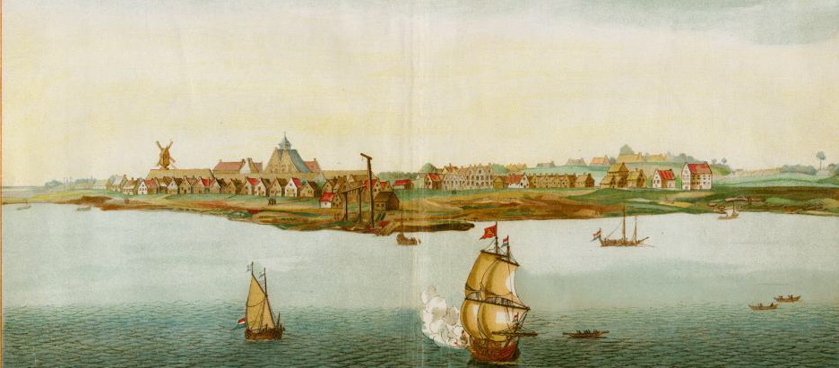
Our Smith ancestors, the von Couwenhovens, settled into the western edge of the island in 1636. Wolphert Gerretse von Couwenhoven was the first European to purchase land from the Native American. At least it was the first recorded transaction still on record. Wolphert and wife, Neeltje, operated as a team. They were shrewd investors. She was the CFO of the family. He was the CEO. They owned a large bouwerie (plantation) on western Long Island. Their home/fort is shown to the left on this map as Amersfoort. Deeds also reveal their purchase of the patent on Rechtkawack to the south and east of Amersfoort.
Within thirty years of Wulfert’s arrival, the Whittington side of our family began encroaching on the eastern end of Lange Eylandt in the vicinity of the Hamptons. The English claimed the eastern two thirds of the island, below Connecticut, and understood the strategic importance of the Dutch port city, New Amsterdam. They would seize Manhattan and the Hudson River Valley for themselves in 1665. For a map of New Netherlands in 1645.
Notice the changing of spellings as the British influenced the naming of communities: Hamton became Hamptons, Breukelen became Brooklyn and Lange Eylandt became Long Island. And Wolphert’s front yard eventually became the Twin Towers.
Click on map to enlarge image for viewing detail. Please use your back button to return to your previous page.

New Amersfoort, New Amsterdam
The Manatus Map (Manhattan Map- 1639), shown below, is the oldest known, existing map of the ‘New York City’ region including Staten, Long and Manhattan islands. The original title, ‘Manatvs gelegen op de Noot Riuver’ translates ‘Manhattan on the North River.’ Our Dutch ancestors were housed at one time on the west end of Long Island and also on Manhattan Island, in the vicinity of the World Trade Center Park.
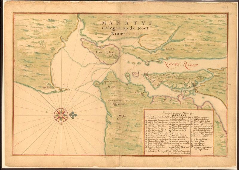
Manhattan & Long Island
